
Lake Garda Wind Forecast
Check the latest wind conditions
& forecast for Lake Garda
On this page, you’ll find a quick overview of the most reliable wind models and live webcams for Lake Garda — the same tools we use every day at Mint Kiteboarding in Malcesine.
Learn to Read the Wind Forecast (Beginner Guide)
This page gives you a quick overview of the current wind conditions and forecasts for Lake Garda. If you want to understand how the local wind system works and how to properly read the forecast, check out our in-depth guide.
What you'll learn:
-
How the Lake Garda wind system works
-
How to pick the right kite size
-
Which forecasts to trust — and how to read them correctly
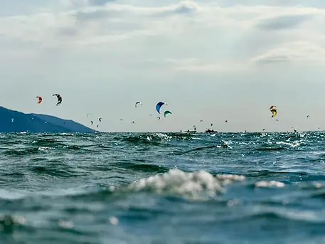
Lake Garda Wind Forecast for Kitesurfers
Lake Garda is famous for its thermal winds — especially the morning Peler and the Ora that builds throughout the afternoon.
If you’re kitesurfing around Malcesine, Campione or Capo Reamol, it’s important to compare different forecast models and understand how the wind is expected to develop during the day.
On this page, you’ll find:
-
The most important wind forecast models for Lake Garda
-
Ora and Peler forecasts
-
Models especially relevant for Malcesine, Campione and Capo Reamol
This overview is intentionally kept short and practical — ideal for experienced riders who want to quickly check the latest conditions.
Check Live Wind Conditions on Lake Garda with Webcams
Forecasts are important — but nothing beats a live view of the spot. That’s why we’ve included selected live webcams from around Malcesine, Campione and Capo Reamol.
Use the webcams to:
-
Check the conditions in real time
-
See the current wind speed and gusts
-
Monitor how the wind develops throughout the day
Lake Garda Wind & Weather Forecast
Malcesine Weather Forecast
The weather forecast for Malcesine is one of the key indicators for thermal wind conditions on Lake Garda.
Rule of thumb:
☀️Sunny = Great chances for reliable thermal wind
☁️ Cloudy = Weaker thermals and more weather-driven wind conditions
Lake Garda Pressure Chart
The pressure chart between Bolzano and Brescia/Ghedi shows the air pressure difference in hectopascals (hPa) — a key indicator of wind strength on Lake Garda.
Rule of thumb:
The bigger the pressure difference, the stronger the wind.
±2 hPa → often good kitesurfing wind
±3 hPa → often around 20 knots
Typical Lake Garda reference values:
Lake Garda Wind Flow Chart – Meteotrentino ICON2
The Meteotrentino ICON2 flow charts show wind speed (m/s) and wind direction for the northern part of Lake Garda around Capo Reamol, as well as the central lake area around Malcesine and Campione.
RichtweRule of thumb:
Ora: forecasts are usually quite accurate (8 m/s ≈ 15 knots)
Peler: even forecasts of 2–3 m/s can already mean around 15 knots on the water
Lake Garda Wind Model – AROME
The AROME wind model provides highly accurate short-term forecasts for Lake Garda and takes local effects like thermal winds and valley systems into account. That makes it especially reliable for predicting Ora and Peler conditions.
↙ Arrow = northerly wind (Peler)
↗ Arrow = southerly wind (Ora)
Lake Garda rule of thumb:
Add around 5 knots to the forecast gusts for a more realistic estimate of the wind strength on the water.
Chart guide:
Lake Garda Live Webcams
Check Wind & Conditions in Real Time
Use the live webcams around Lake Garda to check the current conditions in Malcesine, Campione and at Capo Reamol.
Alongside the live camera view, the webcams also provide updated wind readings every 10 minutes, so you can track wind strength and changing conditions in real time.
This gives you a quick and reliable way to see whether the wind has already kicked in and how the conditions are actually developing on the spot.
Webcam Malcesine – Windsquare Windstation
Courtesy of Addicted Sports
Webcam Capo Reamol – Wind Limone
Courtesy of Addicted Sports
Webcam Malcesine – Camping Azzurro
Courtesy of Addicted Sports
Webcam Torbole
Courtesy of Addicted Sports
Webcam Campione
Courtesy of Addicted Sports